

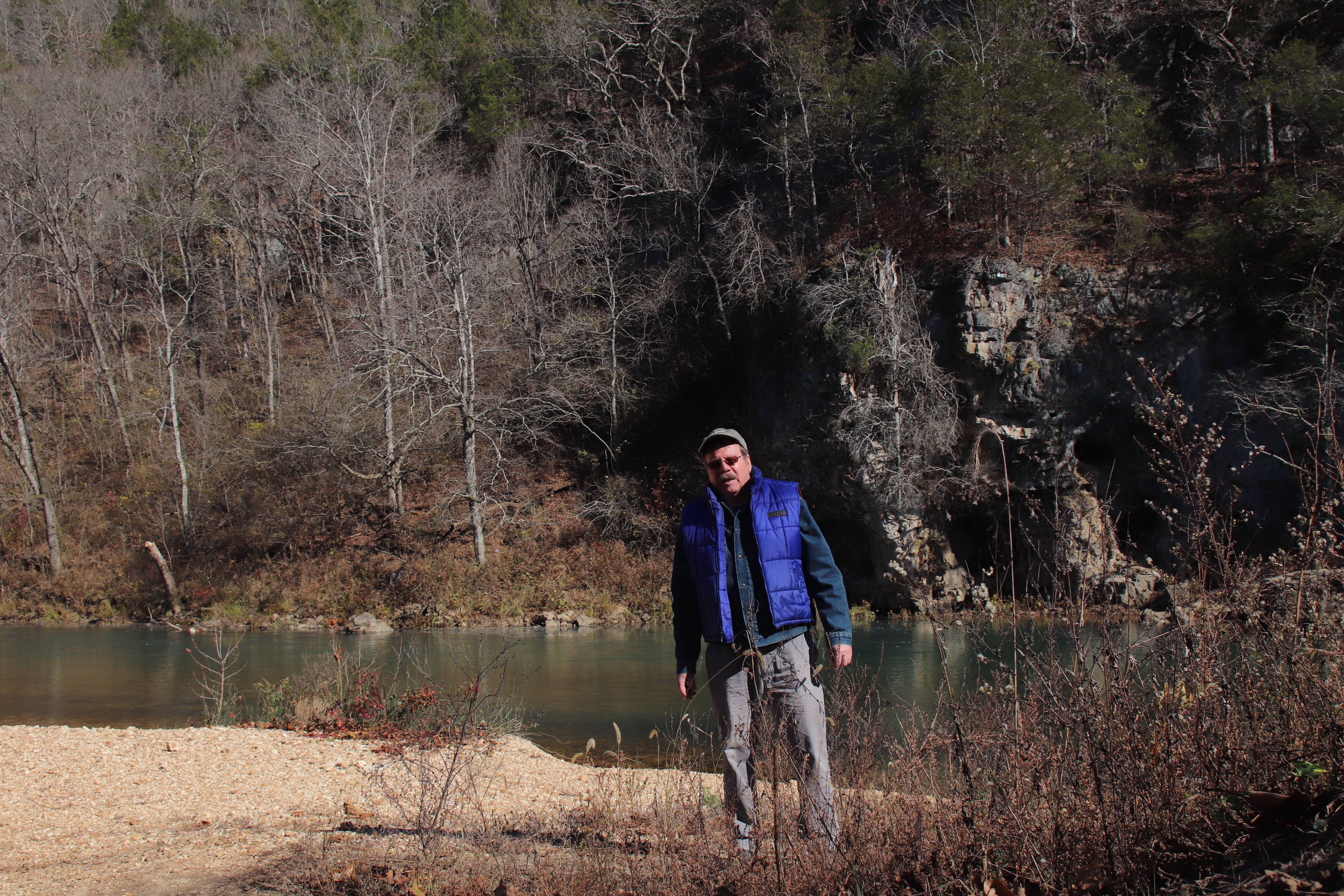
Lots of sun and clear skies are essential for a comfortable canoe trip on a cold fall day, as well as a few restful stops as Don Corrigan takes here on the Current River.
by Don Corrigan
Forget a raging viral pandemic. Forget the raging political chaos. Forget the raised voices – the blame game and finger-pointing. This nature boy retreated to the wilderness of the Roger Pryor Pioneer Backcountry in the Ozarks to forget the whole, tired, human mess for a little while.
And did I find peace of mind on the waters of the Current River in a land bereft of cell phone reception?
No. Not at all. I discovered a giant crack in the Earth. I discovered an ancient rift known as the “Missouri Gravity Low.” It runs from northwest Missouri to southeast Missouri and is estimated to be a billion years old. It is part of a larger 1,700 mile “Crack Across America.”
If the “Missouri Gravity Low” ever gives way, we are all sunk. We will all be put out of our Missouri … I mean Misery. We will fall into a crack in the Earth that last saw a bit of activity in New Madrid in 1811-12. We could fall into what’s called the “Midcontinental Basement,” a fracture so deep, it might as well be halfway to China.
The “Missouri Gravity Low” involves fissures and fractures that are totally inaccessible since they involve continental tectonic pates, and miles of sediment or crust above that hide telltale signs of crustal creep or tectonic stress below. Still, there is evidence that the gravity low is real.

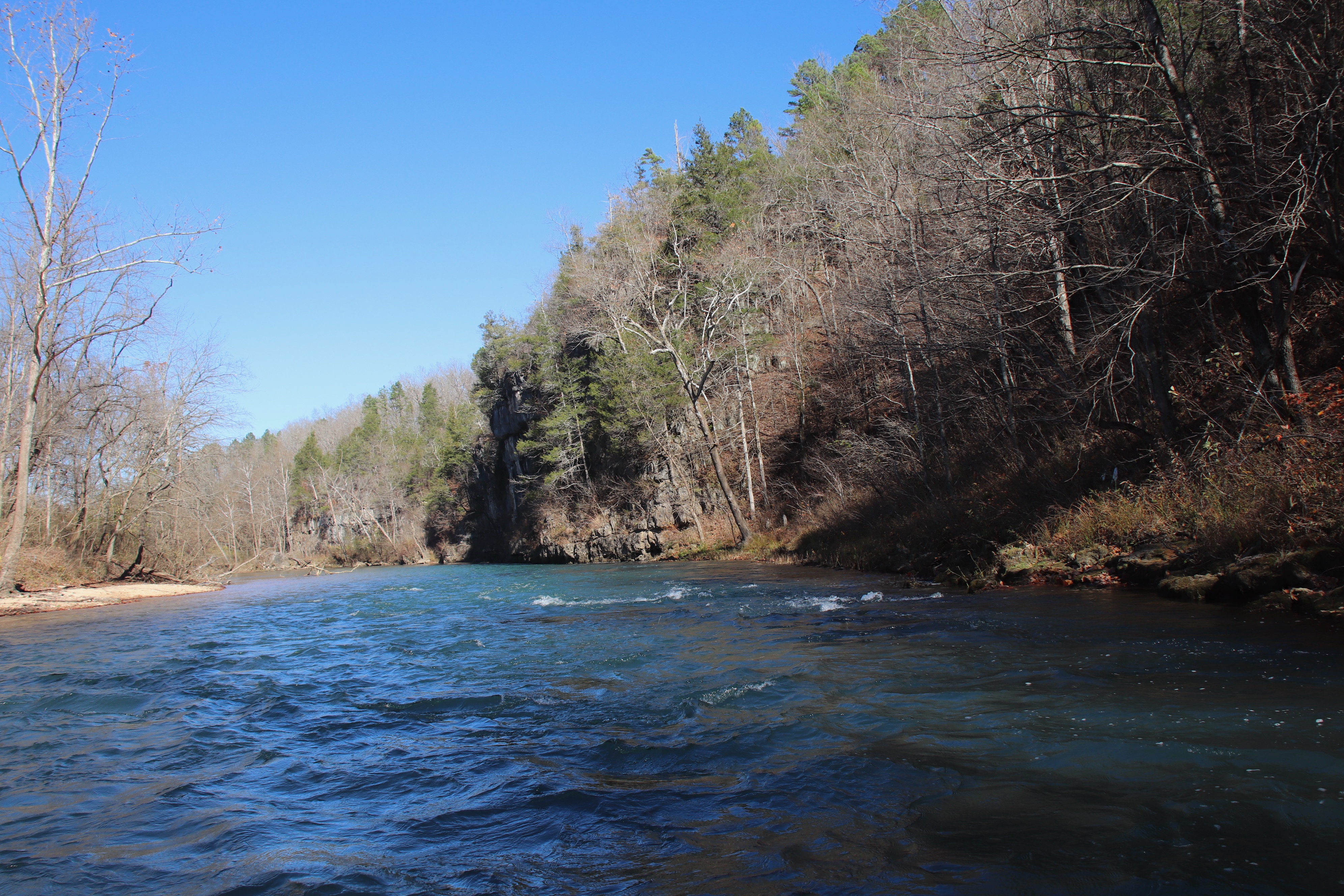
Rocky bluffs, cliffs and knobs on Ozark streams offer strong evidence that the “Missouri Gravity Low” exists beneath their heights.
When canoeing down the Current River in the direction of Two Rivers, where the Jacks Fork meets up with the Current, you see outcroppings and bluffs and Proterozoic volcanic rocks that form knobs. These silica-rich rhyolitic rocks are more resistant to erosion than surrounding rock.
These hard rock knobs are part of the Eminence Caldera, one of the Proterozoic volcanic eruption locations of southern Missouri. The movement of volcanic magma here dates from 540 million years ago or more and is associated with the faults of the “Missouri Gravity Low.”
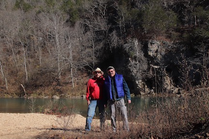
Emery Styron (left) and Don Corrigan take a needed break on a sandbar on the Current River a few miles above Round Spring.
Echoes of a Past at Echo Bluff
My original intention in heading to the Ozarks was to find a safe place to get away from political noise and scary pandemic. My guide was Emery Styron, the former editor and publisher of River Hills Traveler. In that position, he has traveled thousands of miles in the Ozarks and knows lots of rural folks.
He knew the Ozark outfitter who drove us and our canoe to the put-in at Pulltite Spring. The driver was amiable and wore a mask to stave off pandemic microbes. He told us of some of the COVID-19 casualties in his Shannon County. Sickness and death makes us all believers. We wear masks.
 Emery also knew that Echo Bluff State Park is the place to go to get rest and provisions before launching on a river trip on a cold fall morning. The park and lodge are near the namesake bluff, the largest sheer bluff on the park property. It’s just below Sinking Creek, a large tributary of the Current with deep pools for bass to swim.
The lodge staff was extremely helpful and they all wore masks as did all the guests. One employee told us of a colleague that became sick with COVID-19. Wearing a mask to stave off pandemic microbes is just good science and good sense. And the sickness of close friends makes us believers.
The roaring fire at the lodge was adjacent to deep comfy chairs and a shelf full of books on history, literature and natural science. The books and the fire kept me captivated until midnight. T.S. Eliot’s poetry transfixed me – for a while. This Missourian, Eliot, has great metaphors for rivers and for fog, but his poetry is generally as inaccessible to me as it was in college.
I enjoyed the biographies of Missourian Mark Twain, but there is nothing new in his disillusionment over the venal and spineless duplicity of the human race. And many of his fellow Missourians are still as susceptible to blowhards, knaves and demagogues as they were in his day.
Then, I opened the pages of Missourian Charles G. Spencer’s “Geology of Missouri.” He almost lost me with his trip through the eons to describe the formation of metamorphic rocks, igneous rocks and sedimentary rocks. However, he had me with his discussion of the “Missouri Gravity Low.” I had never heard of it.
This geological phenomenon is a fault-bound structure filled by granite batholith that has a lower density than rocks on either side. It extends from the Midcontinent Rift to the Reelfoot Rift and beyond. This puts Missouri and the Ozarks smack dab in the middle of a crack in the Earth.
In Search of “Missouri Gravity Low”
My recent Fall 2020 trip with Emery rowing down the bucolic Current River will not be my last, and hopefully, future river floats will be in brighter and safer times. The virus must be contained – and soon. There is much fear and loathing in the central lands of the “Crack Across America.”
Current River canoe trips can be very relaxing, but for safety sake it’s important to be on the lookout for swift narrows and tree snags that can tip canoes.
On Ozark journeys to come, I will continue to visit my favorite haunts in this enchanting part of the country, including Round Spring, Alley Spring, Blue Spring and Rocky Falls. Then there are those tall bluffs and cliff areas to enjoy: Coot Mountain, Bee Bluff, Tunnel Bluff Woods, Cardareva Bluff and Kelley Bluff near Doniphan.
However, my future river missions also will be used to search for the remnants of the “Missouri Gravity Low.” These volcanic fragments and remains are from a prehistoric time when lava flowed in the Ozarks. That lava is frozen rock now and holds secrets of an unimaginable past.
Back home in St. Louis, I have done more research on the “Missouri Gravity Low.” A New York Times article from 1981 says that the space-age technology that helped map the planet Mars was also used to discover “a down-to-earth geological phenomenon – the Missouri Gravity Low.” The ancient rift extends from Idaho, through Missouri, to the southern Appalachian Mountains. The rift is twice the length of the San Andreas Fault in California.
Dr. Raymond E. Arvidson of Washington University in St. Louis and his research team used data processing techniques developed for planetary studies to synthesize 600,000 discrete gravity measurements of the North American surface. Without the new techniques, a geologist would be overwhelmed by all the data covering such a vast area.
Arvidson explained that computers generated a color image of low- and high-gravity areas, which were compared with topographical maps. And thus, the rift known as “Missouri Gravity Low” was destined to emerge.
While the rift now is mostly inactive from a seismic standpoint, its intersection with the Reelfoot Rift underlying the Mississippi River Valley seems to have created a ”zone of weakness” 60 miles by 30 miles across. This is an area southeast of the Ozarks at the border of the states of Missouri and Tennessee.
Arvidson said the intersection, south of New Madrid, Missouri, was the epicenter of the earthquakes in 1811 that changed the Mississippi River’s course. Some 1,000 small local earthquakes occurred in this area between 1974 and 1979. Tremors continue to this day within this zone and a massive quake, like the one from 200 years ago, is always a possibility.
 Nature’s power has a way of taking the mind off the temporary travails of a human health crisis from pandemic. So does a lengthy canoe trip on a cool fall day – and the thought that far below the water riffles and your dipping oar, there may just be a piece of the “Missouri Gravity Low” formed before anyone knew God.

Hi Don. Emery said I should post this geological tome here. I hope you are enjoying sort of retirement, and Merry Christmas and best for a better 2021.
Don, I hate to tell you, but there is no big crack from NW to SE Missouri at nine miles deep. A gravity low such as this merely tracks a zone of different rock composition, in this case a younger frothy granite and equally frothy, but less crystalline, more compact rhyolite differentiated from an older subcrust formed 1.6 to 1.9 billion years old. This older crust was higher in heavy mafic minerals (iron/magnesium/manganese/olivine/pyroxene). None of this is exposed at the surface anywhere. it is only known from a few deep drillings at magnetic highs and gravitational studies such as http://www.usarray.org/public/about/what Other than a few places of contact metamorphism, there are no metamorphic minerals in the state except these deep layers.
The North American continent formed by accretion of floating crustal masses, just like blobs of fat will float and glob together as you cool a pot of stew. Suture zones formed where the rocks cracked as they cooled and shrunk, but these are not crevasses, they are cracks. Once it became semi sold, and the heavier crustal blobs had sunk, the lighter bits, still hot, rose to the surface, and formed the usual volcanic/hot spring/caldera sorts of activity, both from internal heat, and from additional heat added due to plumes in the mantle. The latter was the condition of Reynolds/Shannon/Iron/Wayne and parts of Madison counties–9 or 10 large explosive silica magma calderas which built on top of and along the southern edge of the metamorphic subbasement from about 900 million to 1.5 billion years ago, mostly between 1.2 and 1.4 Ga.
Repeating the above in plain English: say you lay down blue and purple hot Play-Doh, squashing them edgeways to cover a surface. As they cool, the edges between them shrink and cracks form. Then you reheat the Play-Doh by putting a candle below it. The frothy bits (silica rich magma) rises, and fills in those cracks, thinning the heavier Play-Doh below. This happens without volcanic activity. The whole thing cools again, filling the former cracks.
In the course of a billion years, you lay multiple thin layers of white and gray flour paste (sedimentary rock) over the Play-Doh. It all hardens. Next you fly a bunch of planes over it with gravimeters on the planes, pointed downward. You detect a gravity low along those former Play-doh edges, and you name it the Missouri Gravimetric Low. You are detecting the difference between two sorts of igneous rock –dark and heavy and light and fluffy. (If you consider granite and rhyolite “fluffy.”)
An editorial note: the Roadside Geology series of books are self-funded and self-edited. Once published by Mountain Press, the author gets royalties. I personally have some doubts about a number of things in this book. One thing: you crossed this gravimetric low on your way to Shannon County, but the Precambrian rock you saw on the river, like Coot Mountain, slightly upstream and across from Two Rivers is a sedimentary buried Precambrian knob, part of the Eminence caldera, and a worn down remnant similar to the unburied Taum Sauk, Proffitt and Church mountains and the unburied granite plutons at Elephant Rocks. Tufa Creek, my geology study site, runs along the north side of Coot Mountain, and that big knob across from Two Rivers.
Have fun and stay well!
Jo Schaper
LikeLike
Such an interesting article on things I had no clue about. Thanks for sharing.
LikeLike