
Rendering of new boardwalk (part of greenway) across restored wetland. Courtesy Great Rivers Greenway.
By Don Corrigan (Webster-Kirkwood Times)
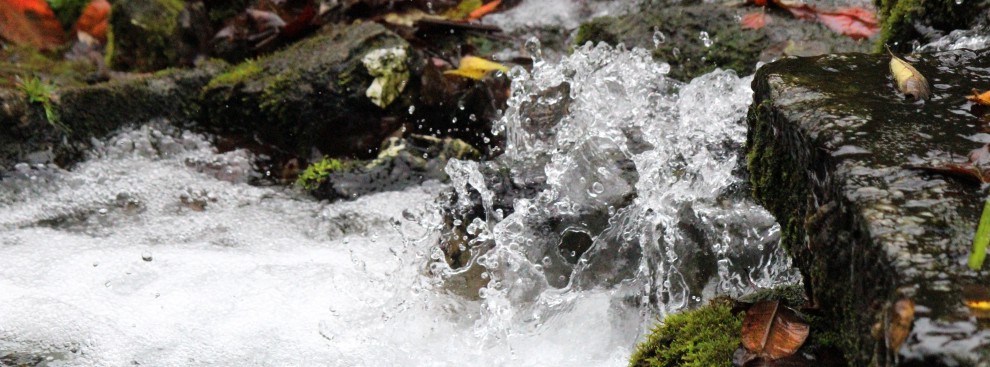
As the waters slowly recede from a record 2019 flood – both in terms of duration and height of crests – hikers and bikers are coping with mud, sand, tree limbs, plastic bottles and other debris on some of their favorite trails.
In a few cases, asphalt has been washed out on trails posing a potential crash hazard for bikers. In other cases, cracked tree branches dangling above trails can present serious obstructions or danger to those daring to hike or bike underneath the large limbs.
“We are getting phone calls from trail users about debris and other issues,” said Anne Milford, communications coordinator for Great Rivers Greenway. “We welcome those calls, because our office cannot monitor what’s happening on all of our 125-plus miles of trail.

“We have a partnership with cities like Fenton, Sunset Hills, Kirkwood and St. Louis County and we forward the concerns to them,” said Milford. “They deal with damaged or cluttered stretches of the trail in their jurisdictions and they are very good about getting things cleaned up and usable again.”
Milford did advise that trail users need to be patient as the flood aftermath is addressed. Trail maintenance is not always at the top of the list for local cities or for St. Louis County.
“Their first responsibility may be to clear Marshall Road or Riverside Road,” said Milford. “But they react pretty quickly to clearing off the trails in the period after flooding.”
Bikers and hikers found spring flood issues on trails along the Meramec River in Fenton, Kirkwood and Sunset Hills. One exception was the trail atop the levee protecting Valley Park.
Trails in Cliff Cave Park were closed, as were other trails along the Mississippi River both north and south of downtown St. Louis. A big exception was Grant’s Trail from Kirkwood, through Crestwood, on to South County. It stayed open and handled more biking and hiking traffic than normal.
“There is a bottom land spur off of Grant’s trail along Gravois Creek that we had closed due to flooding,” said Milford. “And there is a section of that spur that has been closed off for more than a year because of flooding that led to erosion of that trail area.”
Trailnet Activities
Trailnet – which has the mission of promoting walking, bicycling and the use of public transit as a way of life – has seen a number of its activities disrupted because of spring rain and flooding.
“It’s had an impact on our Route 66 Chain of Rocks Bridge celebrations,” said Cindy Mense, CEO for Trailnet. “It’s affected a number of our activities on the Katy Trail, which has seen plenty of flood water. Even after the water leaves, some trails are impassable because of sand and mud and debris.
“With our activities, we can deal with the floods because we can reroute our events around the water,” said Mense. “But if it’s raining, we cannot so easily reroute around that. We’ve had some cancellations this spring.”
Mense and her Trailnet crew are keeping their fingers crossed that weather will not affect a “Rail to Trail” event on June 29-30 that starts at the Kirkwood Amtrak station. The two-day ride will feature great food, scenic views and music along the way.
Trailnet planners also are hoping the Mississippi River recedes from the Illinois bottomlands by mid-July. A “Bike for Heroes” ride is slated for July 20, with a route along the Mississippi Bluffs heading south out of Columbia, Illinois.
Floods: Part of the Deal
“We expect the trails to flood every so often – that’s normal,” said Milford. “Part of our greenway mission is to utilize bottomlands for recreation and exercise on trails. It’s land that might otherwise be torn up and used for development.
“Bikers and hikers who are frustrated need to keep in mind that these trails are partly about preserving wetland areas,” added Milford. “So even when the trails are under water, they are still fulfilling an important function.”
Wetlland Restoration
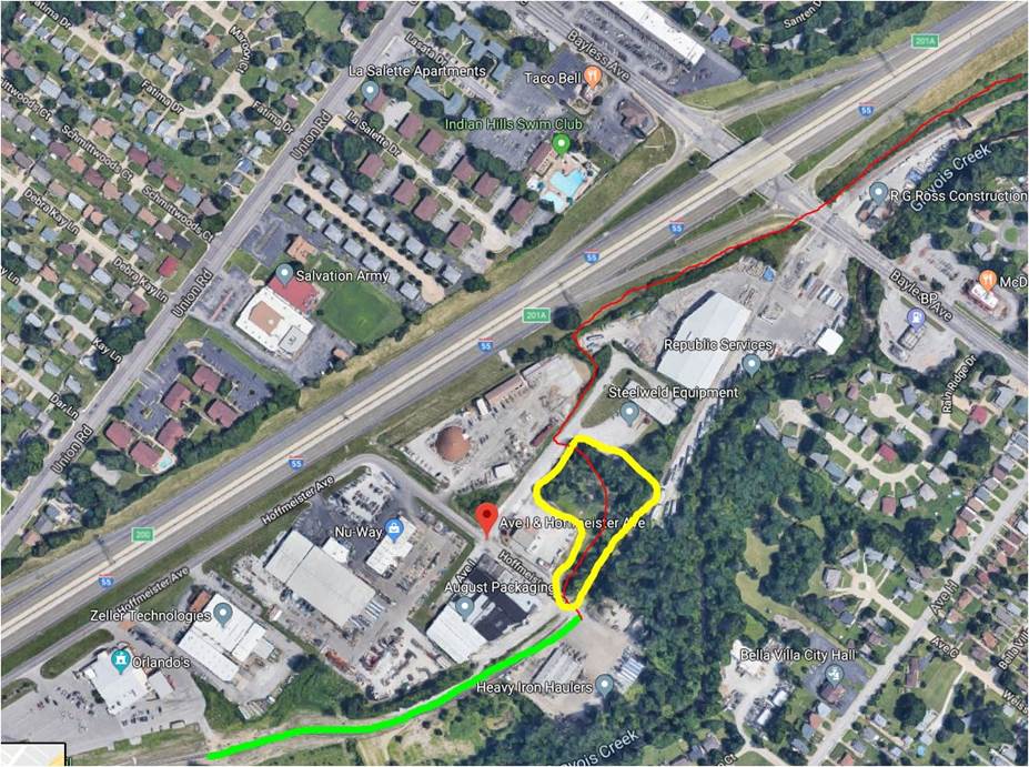 Great Rivers Greenway has started a wetland restoration project at the east end of Grant’s Trail just north of Orlando’s Event Center in South County. The wetland project will include a boardwalk that’s 600-feet long to be used by hikers and bikers. (Rendering of new boardwalk pictured at beginning of story.)
Residents of the Kirkwood /Oakland end of the trail will bike or hike past the Sappington House, Grant’s Farm, the Affton Athletic Association fields and Gravois Creek to get to the boardwalk and the restored wetland.
“We purchased a 1.3 acre property at the corner of Avenue I and Hoffmeister near the eastern trailhead by Orlando’s for this project,” said Anne Milford of Great Rivers Greenway.
“Our goal for this new property is threefold: to route greenway users away from trucks on Avenue I; to restore the wetland area and improve its habitat; and, to provide a green space respite area for a better user experience along the way,” Milford explained.
The Grant’s Trail connection to River des Peres Greenway won’t be completed until the spring of 2020. The boardwalk for the wetland restoration project will be an impressive, natural feature of the expanded trail route.
