
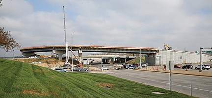
Missouri Route 141/Interstate 44 intersection. Photo by Ursula Ruhl (SCT).
Officials with the U.S. Army Corps of Engineers told a concerned audience at the Powder Valley Nature Center on Nov. 1 that there’s undoubtedly more rain — and flooding – in the long-range weather forecast for this area.
Mayors from Kirkwood, Fenton and Valley Park, along with about 70 area residents, attended the Corps’ Meramec River Flood Risk Workshop. Local mayors introduced themselves before the program began and noted damage to their towns by flooding since 2015.
“No one has the magic answer on how to stop the rains or stop the flooding,” said Fenton Mayor Josh Voyles. “But we welcome the chance to discuss how we can prepare for future flood events here tonight.”
By Don Corrigan (South County Times)
Valley Park Mayor Mike Pennise noted his town’s recent bouts with flooding were particularly tough on businesses outside the town levee. He thanked organizations that helped the city deal with record-breaking flood waters on two occasions since 2015.
“Kirkwood is very lucky,” said Kirkwood Mayor Tim Griffin. “We don’t get the devastation that Fenton, Sunset Hills and Valley Park get in parts of their cities. Our damage is pretty much confined to our Greentree and Emmenegger parks where we do suffer damage to their banks.”
Murray Pounds, director of parks and recreation for Kirkwood, attended the Nov. 1 meeting. He can attest to the huge bites of real estate taken from Emmenegger Nature Park by swift flood waters in 2015 and early 2016.
Matthew Hunn, who heads the Emergency Management Branch of the St. Louis District of the U.S. Army Corps of Engineers, began the Nov. 1 program with a very brief reference to climate change and the unprecedented weather events.
“We’re not going to tell you about climate change,” said Hunn. “We’ll just tell you that it has rained a lot in recent years.”
Corps officials said there have been 79 flood disaster declarations in America in 2016 costing U.S. taxpayers billions of dollars. They also underscored 11 major flood events locally in the past decade costing millions.
Randy Behm, a hydraulics engineer with the Corps, also noted the huge costs for three hurricanes in 2017. He said the Gulf Coast area alone would see damages exceeding $100 billion.
“Is this the new normal we are going through?” said Behm, and noted that more Americans are asking this.
Behm said floodplain maps are outdated in places like the Meramec River Valley. He said floodplain areas are expanding even as more residential and commercial development is approved for these same flood-prone areas.
Valley Park Levee
Corps officials said there is growing awareness that dams and levees are not always the answer to flood mitigation. They offered other options both in the meeting and in materials on Powder Valley tables after the meeting, which lasted more than two hours.
A Meramec River Valley Park Levee Fact Sheet was provided for the public by the Corps after the meeting. Some assertions continue to be greeted with skepticism by area residents and authorities on water management.
The Corps asserted that the levee was not built too high, or exacerbating area flooding as some critics suggest. Among the Corps points:
• The levee height is based on a 100-year flood level, plus three feet of “free board” and extra height to account for post-construction settlement.
• Any points that measure higher than this range are either permitted utility crossings or pedestrian walkways. Levee height is in full compliance with all authorizations and laws.
• Fenton, Wildwood and Eureka are not impacted by the levee and the levee does not increase flood heights anywhere downstream of Valley Park.
The Valley Park Levee came under fire in 2016 after that Meramec River flood. Critics said the levee caused unprecedented volume and speed in the water torrent that hit Fenton, Kirkwood, Sunset Hills and Arnold.
“The Corps fails to mention that they fudged the ‘100-year’ level to their liking for the levee, so that their figure disagrees with FEMA’s own computed level,” said Bob Criss, an earth and planetary science professor at Washington University.
“The Corps’ allowance for levee ‘settlement’ is huge and far exceeds their calculations,” said Criss. “A combination of ‘fudges’ has rendered the height of the levee much too high, compared to what the Corps said they were authorized to build.
“Moreover, that level is too high along the entire 3.2 mile length, and even higher in the restricted areas of concrete and utility crossings,” noted Criss. “Levees increase flood heights both upstream and downstream.”
Climate Change Issue
David Stokes, who attended the Corps’ meeting, questioned why officials dismissed talking about climate change impact in Missouri and the Meramec River Valley. Stokes is executive director of Great Rivers Habitat Alliance.
Stokes said that overall, he thought the Corps had a good informational meeting, but he said avoiding the elephant in the room – climate change – was a serious omission.
Criss said the Corps has tended to embrace climate change in the past, as “they want to blame floods on too much rain” from a changing climate, rather than implicate their own structures for causing problems.
“Any newfound reluctance to mention ‘climate change’ probably reflects the hostility of the Trump administration to that concept,” said Criss. “So instead of mentioning climate change, the Corps now dances around it and discusses in detail how there’s been a lot of rain lately.”
According to Stokes, the Corps did give useful information to city officials and business owners on how to take steps on a “micro level,” to protect property and residents from flooding.
“I also thought it was a positive that Behm said the Corps is realizing that levees and dams are not the only way to address more flooding events.
“On the negative side, I think the Corps should have taken the opportunity to stir area mayors into the discussion at the meeting,” said Stokes. “And I think mayors should have been asked what they are doing to discourage increasing development in floodplains in their own cities.
“After all, development in flood plains raises water levels and costs the taxpayers when damages occur,” said Stokes. “Mayors and their cities have the zoning tools and authority to impose tougher rules on these developments, if they have the will to do it.”

The Feds, specificallly FEMA and the SBA have to take a few lumps for the increase in floodplain heights. Instead of buyouts, the answer du jour is to provide loans to “build up,” that is, to jack up structures a foot or two, add fill beneath those where it is possible, and put berms around other structures. When the water comes again, those structure footprints are larger, hence the water goes higher since it cannot occupy the same space. The water goes back into the structures, at a higher level, and the only people getting rich are the construction companies, and interest to the banks who provide the loans.
And the flood levels keep rising.
LikeLike
People are still asking whether the Meramec Dam would have solved all the river flooding problems. I wish the Corps would have had a question and answer program for this at their recent meeting instead of such a long program which frankly tired a lot of people out for the evening. I hear that the dam was not really a good idea because of so many caves, sinkholes and hollowed out karst rock in the area — like a swimming pool with lots of holes in it. I bet astral frog, who commented previously, has some ideas on that.
LikeLike