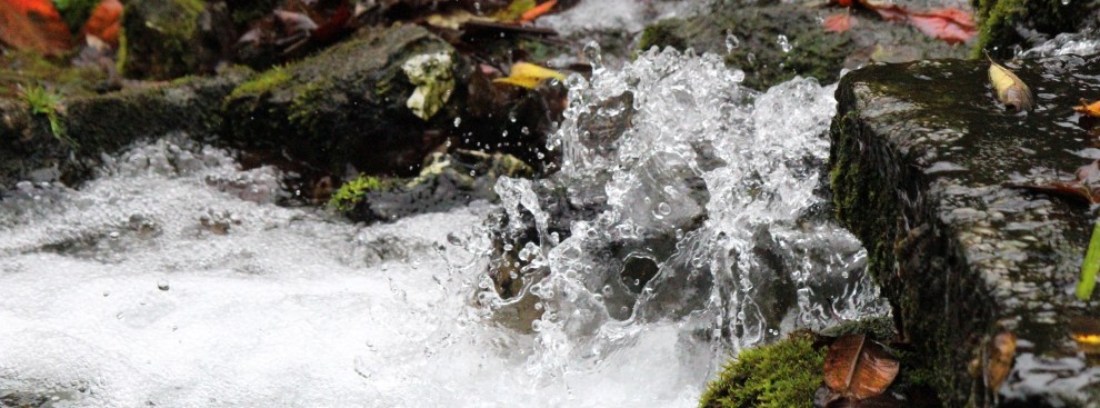
Water over the top of Marshall Road in Kirkwood. photo by Diana Linsley, Webster-Kirkwood Times.
“We had a torrent, a white water situation coming down at us in Fenton,” Fenton Mayor Mike Polizzi said. “To give you an idea of what happened, that house that went under our bridge raced down to us all the way from Eureka. The Meramec is not the same river and it’s troubling.”
To hear the Environmental Echo interview with Professor Bob Criss click on audio below.
By Don Corrigan (Print story below from the Webster-Kirkwood Times)
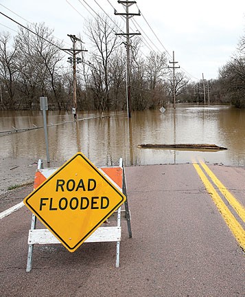
The Meramec River Valley is still recovering from a 2015 “flood of biblical proportions,” to use an overwrought phrase. Local officials are worried that 2016 spring rains and flooding could bring a repeat of the nightmare that came in late December.
Fenton Mayor Mike Polizzi said he believes a repeat flood scenario could come as early as March. And he blames the levee upstream, built to protect Valley Park, as the culprit in the depth of the recent flooding and the speed of the water raging through southwest Kirkwood, his own city of Fenton, and east on to Arnold.
“There’s no question levee building, and the one built in Valley Park, have exacerbated the situation for flooding,” said Polizzi. “It’s amplified the effect. We have never had the soccer park under 10 feet of water — and it was a minimum of 10 feet.
“We had a torrent, a white water situation coming down at us in Fenton,” added Polizzi. “To give you an idea of what happened, that house that went under our bridge raced down to us all the way from Eureka. The Meramec is not the same river and it’s troubling.”
Fenton suffered extensive business and residential damage in the millions of dollars. Kirkwood’s damage was mostly confined to park areas, such as Greentree and Emmenegger parks in flood plain areas of the city.
Murray Pounds, director of parks and recreation for Kirkwood, agreed with Fenton’s Polizzi that he’s never seen the Meramec behave this badly. He and plenty of gawkers watched the out-of-control river from a closed gate at Emmenegger which was once the entrance to the city swimming pool.
“The high level of the flooding was certainly a problem for us, but the real problem is the high rates of flow in the Meramec which damaged our banks and caused erosion we have not seen before,” Pounds said. “I think a lot people watching were amazed by that.
“Of course, the Valley Park levee is definitely a player in all of this,” said Pounds. “I don’t know what the answer is to decreasing the speed of the river and its height in future flooding. I think that is for a meeting of engineers or hydrologists to consider.
“For now people are going to remember what they saw happening at Emmenegger,” said Pounds. “I think we’ll also remember discouraging a guy who was considering putting his kayak in the flooding river.”
Flood Threat Heightens
Bob Criss, an earth and planetary science professor at Washington University, blames increased flooding throughout the Midwest on levees and floodwalls. Urbanization and building in flood plains spurs new calls for levee protection, but constricted rivers have to go somewhere in big storms.
“The Meramec basin saw record high stages set in this flooding, but mostly in the developed areas,” Criss said. “The Valley Park area was ground zero with the biggest change because of the levee, but also because of some landfill and construction that has been put in the area.”
“We may have ‘seen nothing yet.’ The rivers should be flooding in spring, not January,” said Criss. “We could have even higher water this spring, although I expect that on the bigger rivers more than on the Meramec.”
Criss said the Missouri and Mississippi rivers may well experience what happened on the Meramec on a macro scale. Criss said expanding flood plains, not building levees to protect more development, is the answer to the St. Louis region’s high water woes.
He noted that after the 1993 flood, levees were built for Chesterfield and Maryland Heights, and they will just push the water somewhere else. After the 1982 flood, Valley Park got a higher levee, which is now also pushing the water somewhere else.
The Valley Park levee was raised to 44.4 feet. The Meramec River crested on Dec. 31 at 44.1 feet, and officials feared the river town upstream from Fenton was going to go under.
Criss said levees and development have made the old language of 100-year and 500-year floods irrelevant.
“I’ve been arguing that the language about flood risks is tremendously understated now,” said Criss. “We give people the wrong idea when we talk about 100-year floods. It’s balderdash. We are having these floods much more frequently.”
100-Year Floods?
Fenton Mayor Polizzi agrees with Criss that talk of 500- or 100-year floods seems meaningless. He suggested that Fenton has probably experienced a half-dozen 100-year-floods in the past 30 years.
“To my knowledge, this is the first time we had the Meramec shutting down both I-44 and I-55. What kind of flood is that?” asked Polizzi. “March is when we normally get our worst flooding. I’m worried about that. The Mississippi will be high from the spring thaw up north — and the Meramec will have nowhere to go.”
Polizzi knows the Meramec has had several places to go during flooding, including Olde Town Fenton. Heaps of debris and water-logged furniture from businesses and residences have lined Fenton streets in January. He would like some answers on the role of levees in creating such scenes.
“When you see the government building $250 million levees, you have to wonder if what’s behind them is worth that much,” said Polizzi. “Do levees solve problems, or just relocate them? I think the government should get out of the levee-building business.
“But I do think the government has to address what is going on with the Meramec,” added Polizzi. “Maybe some flood plain property up river can be opened up to absorb some of the water next time and give Fenton and Arnold some relief from these floods.”
In Kirkwood, the aftermath of the latest great flood involves less water-logged furniture and drywall and more park lights, ball fields and pavilions experiencing high-water damage.
“I have to say that the Kirkwood Athletic Association (KAA) has gotten pretty proficient at dealing with regular floods,” said Pounds. “But this flood was different and really caused unprecedented damage.
“In Emmenegger Park, the pavilion was 20 feet from the river banks and now one corner of the pavilion has lost the bank underneath it,” said Pounds. “In both Emmenegger and Greentree parks we’ve lost trees and vegetation that hold the banks from erosion.
“We’re looking at how we can shore up these banks for the future,” added Pounds. “Do you bring in truckloads of rock? How much rock do you bring in and at what cost?”

I think Kirkwood is to be commended for establishing parks along the Meramec River floodplain rather than commercial and residential development. Without these vital flood release areas, flooding upstream and down would be even worse for us and neighboring communities. Flooding has been more frequent in recent years. Records from the nearest Meramec River hydrology station at Valley Park:
http://water.weather.gov/ahps2/hydrograph.php?gage=vllm7&wfo=lsx
http://water.weather.gov/ahps2/crests.php?wfo=lsx&gage=vllm7&crest_type=historic
Valley Park:
16 feet – Flood Stage.
19 feet – Moderate Flood Stage.
25 feet – Major Flood Stage.
2000, 2002, 2005, 2006, 2008, 2009, 2010, 2011, 2013 and 2015 (10 out of the past 15 years) the Meramec River crested above 16 feet (Flood Stage) at Valley Park.
(Valley Park levee built and completed in 2005.)
2008, 2009, 2011 and 2015 were among the highest 12 Valley Park Major Flood Stage crests on record, with flooding above 25 feet.
(note: the Meramec flooded twice in 2015, in June and December. The June flood is not yet recorded on the NWS historic crest record, but would come in at 16th highest recorded crest at 24.8 feet.)
Some climatologists predict a liklihood of “warmer and wetter” weather for our region, others predict the “new normal” to be more “weather weirding”……erratic temperature/rainfall extremes.
Is Kirkwood up to the challenge?
The Deer Creek Watershed Alliance lists City of Kirkwood as a partner, however, we do not have a representative. Only a small portion of northeast Kirkwood is in the Deer Creek watershed, however it would be good if the alliance’s recommendations were applied to all of Kirkwood. Maybe someone from Public Works could be a representative?
http://www.deercreekalliance.org/committees
To reduce run-off, we need stronger protections for mature trees in development situations:
http://www.deercreekalliance.org/urban_trees
And get control of infill housing and new development. It’s become outlandish, citizens are complaining. Healthy, mature trees removed for over-sized infill houses built out to property lines, virtually no pervious surfaces left. I am not optimistic about commercial development either. Making B and R6 zoning “flexible” opens the barn door to developer demands, with precedent inviting strongarm lawsuits claiming “arbitrary and capricious” decision-making, resulting in city capitulation. We need the opposite…….firm control of development, much higher run-off and tree protection standards and reduction of impervious surfaces.
Progress has a new definition: smarter and sustainable, rather than just more and bigger. The old models of development are unsustainable…….for Kirkwood, our watersheds and the Meramec River region. We need to be forward thinking, for these issues are not going away, and will only worsen if not promptly and effectively addressed.
LikeLike
I invite anyone who drives west on I-44 to look to your right on the west side of the Meramec River, directly across the river from Emmeneger Park. Two large office buildings sit north of highway 44 on a parcel of land bordered on the north by Soccer Park road. Just a few years ago 12 or more feet of fill was brought to this site, raising the level of the flood plain, and creating in effect a mini-dam for flood waters, when they overtop the banks of the Meramec. The two buildings were then constructed on that fill
where they could ostensibly stand above the flood waters while adjoining properties are at a lower elevation.
That site alone will impact the soccer park – by forcing flood water to back up, slow down and find its way around the filled section of flood plain. That site is probably the primary contributor to the erosion across the river at Emmenegger Park for exactly the same reason – it is diverting flood water out of its natural floodway and up against the opposite river bank at Emmenegger.
At least the levee at Valley Park was built to protect property that has been in that city for a long time.
This fill was brought in specifically to enable new construction in the flood plain immediately adjacent to the riverway, and with apparent disregard for potential impact on nearby properties, which includes the highway.
Other sites where fill has recently removed flood plains from service in a flood include a large parcel (at least 15 acres) of land at Highway 109 and W in Jefferson County, just south of Eureka, which probably contributed to Eureka’s high flood levels. And in Valley Park, in addition to the levee, the entire Meramec flood plain outside of the levee is being filled. When soil fills a flood plain, there is no place for flood waters to go but up.
As long as our city and county governments allow more development and more fill in the flood plains of our rivers, we will see flood problems get worse. It is time for local government leaders to begin to address
the problem on a watershed basis, and not by individual political entity.
LikeLike
Amen, David! I totally agree that there needs to be discussion between communities throughout the Meramec watershed, for a river is like a balloon poodle…..squeeze it here, it pops out there. If communities act like their own solitary fiefdoms protecting their own interests with levees, the beautiful Meramec River will end up channeled or culverted like River Des Peres.
I’m also wondering about run-off from increased density of development, suburban sprawl, impervious surfaces, throughout the Meramec watershed in general. Does MSD or any other agency collect data on output from the creeks and tributaries that feed the Meramec?
LikeLike
Both Gwyn and David’s comments above make a lot of sense. Question is how to get these concerns addressed by the appropriate “powers that be”? We see these things happen, express our opinions, and wait. But, who will act on these legitimate concerns and how do we press the issue with those appropriate decision makers?
LikeLike
By the way, I have checked recent maps and the site I reference in the comment above is actually now a part of the City of Fenton!
LikeLike
Thanks, David. I thought that was a St. Louis County unincorporated area.
btw…….the NWS Meramec River station at Valley Park list of “historic crests” has been updated to include April and June 2015. Including December 2015, that is 3 historic crests last year:
http://water.weather.gov/ahps2/crests.php?wfo=lsx&gage=vllm7&crest_type=historic
LikeLike